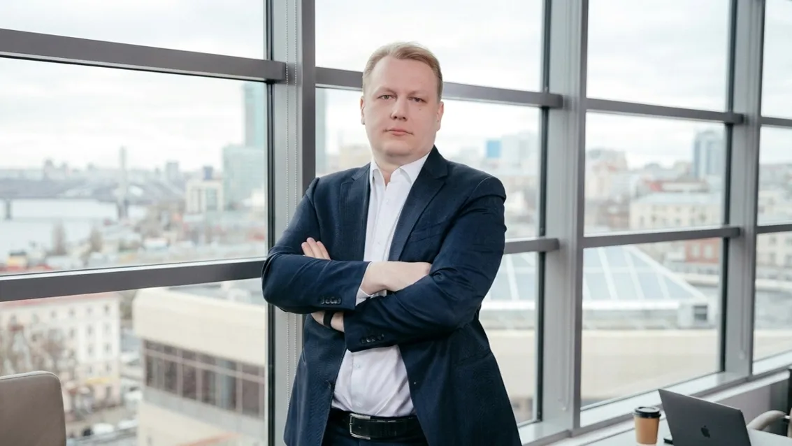
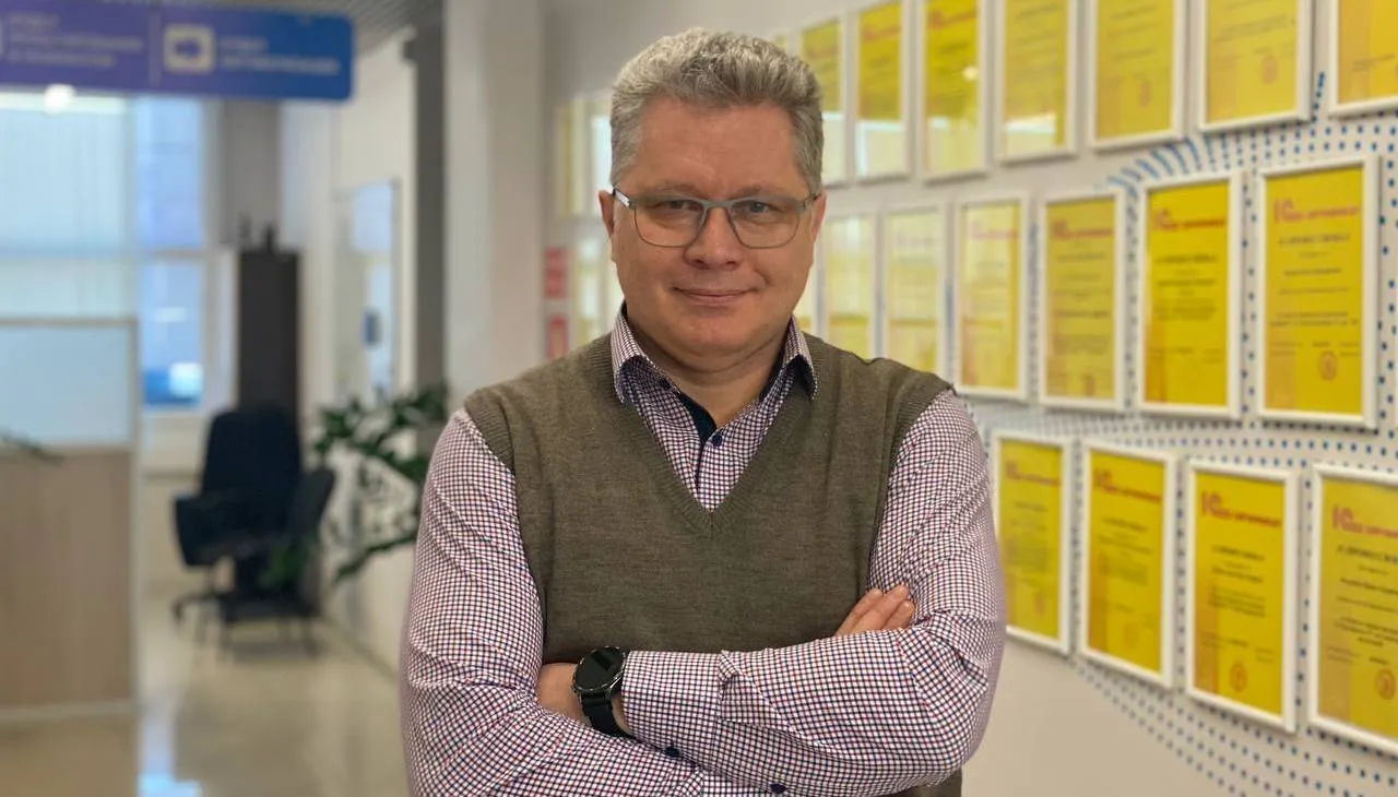
Mikhail Kopyltsov: “Space isn’t somewhere far away — it’s already here”

Mikhail Kopyltsov, Director of Koscom (a company within the Roscosmos State Corporation), explains how “space-based” digital solutions are making everyday life more comfortable and efficient.
Let’s Go!
– Mikhail Valeryevich, you have been implementing IT solutions in Russian regions for many years. What are the prospects for applying space industry developments in citizens’ daily lives?
— Today, Russia occupies a unique position: we not only maintain a sovereign orbital constellation but also know how to “bring data down to Earth” for the practical needs of territories. What was once used solely for scientific or security purposes is now the basis for assessing the socio-economic development of Russian regions. We’re talking about remote sensing (RS) data, satellite navigation, communications, and even meteorological information — all of which help evaluate agricultural productivity, monitor urbanization, track environmental risks, and analyze transport flows.
In our company’s work, we see that space is not about “somewhere far away” — it’s about highly practical solutions for municipalities. These solutions are especially effective when deployed through digital platforms tailored to local conditions.
– Which of your company’s space-based projects would you highlight as most successful?
— Among our implemented projects, I would particularly highlight the “Digital School” and the “School Bus Monitoring System.” Both rely heavily on geolocation data and spatial modeling of territories. The “School Bus” system isn’t just GPS tracking — it’s a comprehensive control system that includes schedules, passenger and driver information, bus conditions, and real-time route deviation tracking. In our pilot launch in the Altai Republic, parental complaints dropped by 73% within the first three months.
The “Digital School” project also integrates elements of spatial analytics — from analyzing transport accessibility to monitoring student density. In several regions, this has helped redistribute institutional load and reduce student transportation costs by 12–17%.
Russia Can Only Be Measured from Space
– In your report to the Interagency Commission on the Use of Space Activities, you spoke about applying data from RKS to evaluate regional development. What does the methodology entail, and how is it implemented?
— The methodology for assessing regional socio-economic development using RKS (Russian Space System) data involves three key stages: data collection, integration, and interpretation. We use high-resolution imagery, vegetation maps, soil productivity data, surface temperature, and building density. These are aligned with the UN Sustainable Development Goals (SDGs). For instance, Goal 11 — sustainable cities and communities — can be partially assessed through satellite data on urban density, street lighting, air quality, and access to green spaces.
Russia’s uniqueness lies in the fact that we track statistics for 89 regions, and in each one we can build a space-time matrix based on satellite data. This is especially important in a country with such uneven territorial development.
– How do remote sensing data align with official statistics? How accurate and compatible are they?
— This is one of the most pressing questions. Currently, in most countries — including Russia — there is a gap between national statistical systems and satellite data. We are actively working to develop methodologies for reconciling these data streams. For example, agricultural productivity figures from Rosstat may differ from NDVI (Normalized Difference Vegetation Index) data, especially in the presence of climatic anomalies, early frosts, or droughts — all of which are visible from orbit but may not be captured in paper-based reports.
The European Space Agency (ESA) is already implementing a model in which over 30% of SDG indicators are collected through Copernicus data. Russia is gradually moving in the same direction. We’ve already adapted drinking water access maps, air quality indices, and “green index” data for regions ranging from Kaluga to Zabaykalsky Krai.
“Space-Based” Digitalization on the Ground
– In which sectors and regions of Russia are these solutions being most actively implemented today?
— Demand is strongest in regions with vast territories and challenging logistics — the Sakha Republic (Yakutia), Krasnoyarsk Krai, Kamchatka, Kalmykia. In areas where remoteness, harsh climates, and limited human resources are factors, satellite data become an indispensable aid. For instance, in Yakutia we monitor permafrost thaw and its impact on transport corridors; in Kalmykia — the drought resilience of pastures.
Utilities (housing and communal services) are another “hot” sector. In Gelendzhik, implementing an automated fare payment system (AFPS) increased transit revenue by 94% due to improved transparency and control. Similar systems are now being rolled out in Tambov, Ryazan, and Oryol.
– What are the main challenges you face when deploying such technologies in Russian regions?
— The primary challenge is the fragmented IT landscape across regions. One region uses platform A for document flow, another uses B, and transport monitoring is still done manually in some places. We often need not only to implement our own solutions but also to act as integrators of disconnected systems.
The second problem is a shortage of skilled personnel. Local IT specialists often lack competencies in interpreting remote sensing data, so we have to develop training programs as part of the project rollout.
Finally, there’s a barrier of skepticism. Officials are not always ready to make decisions based on “space data.” But after the first few cases — for example, optimizing school transportation or monitoring solid waste — skepticism fades quickly.
First in Space and Digital Technology
– What is your company’s role in the national project to integrate space data into the country’s development?
— At the federal level, work is underway to unify all disparate space initiatives — from Roscosmos data to RKS products — into a single national project scheduled to launch in 2024. We are actively involved in expert consultations, contribute our tools, and test them in pilot regions.
Koscom is being considered as one of the operators of platform solutions capable of linking space data to regional planning, management, and SDG reporting. We serve not only as an IT provider but also as a translator of meaning — explaining to municipal leaders why they need a soil degradation index and how to apply it.
– Do you incorporate international best practices in your projects?
— Absolutely. We closely monitor the work of ESA, NASA, and agencies in Southeast Asia. Many ideas — from urbanization assessment methods to air quality indices and electricity access monitoring — are adapted to Russian realities. For example, we’ve implemented an analogue of the Global Surface Water Monitoring system, which tracks water bodies and seasonal changes — extremely useful for the Volga region and southern Russia.
At the same time, we’re in a unique position because we have our own orbital constellation, enabling us to build independent data processing and storage channels. This is the foundation of digital sovereignty.
– What are your priorities for the next two years?
— First, expanding the geographic scope of pilot implementations. We plan to reach at least 30 regions by the end of 2026. Second, improving data quality and interoperability. We’re now configuring a unified platform that integrates data on transport, infrastructure, ecology, and demographics, and visualizes it through a user-friendly interface.
Third, contributing to new standard development. We are proposing the inclusion of an RKS-based module in the federal methodology for territory assessment. This will enable more accurate forecasting and help prevent planning errors.
![Astra AI [Code] vs. Open Source: Why Deploying an Open Model in a Secure Environment Is Costly and Risky](https://storage.yandexcloud.net/itrussia/uploads/c3b5b6da-1bf7-49cb-817e-0bab1cea8cff.webp)