A 17th-Century Map of Siberia Is Digitized
Russian students are helping preserve a rare historical map by turning it into a high-resolution digital record.
Students at Saint Petersburg Electrotechnical University “LETI” have digitized an old map, according to the university’s press service.
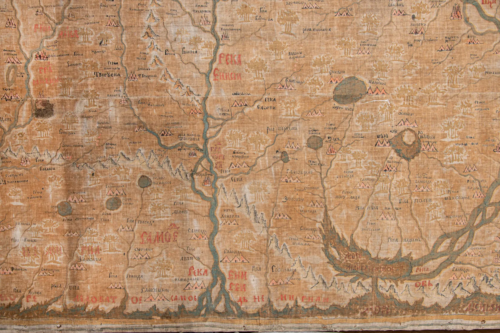
The map, titled Chertezh Sibiri ot granits kitaiskikh (Map of Siberia From the Chinese Borders), was created in the 17th century. It was the first to depict in detail the terrain, roads, and geography of Siberia and the Russian Far East, as well as the Urals and the Arctic. The document is a unique original produced in the traditional Russian cartographic style by scholar Semyon Remezov.
According to the university, the map is oriented south rather than north and does not use mathematical projections. Instead, it incorporates information on the region’s history, ethnography, and economic activity, making it a living chronicle of Russian history.
A Digital Copy for Preservation
To preserve the artifact, students used laser-based 3D scanning. The digital copy captures the document in its current condition. Researchers plan to create new 3D models in the future and compare them with the original scan to assess how well the artifact is holding up over time.
Remezov’s map is drawn on cotton fabric measuring 213 by 277 centimeters. It is housed at the State Hermitage Museum in Saint Petersburg. Visually assessing the condition of an object of this size is extremely difficult, which is why researchers decided to rely on comparisons of digital copies taken in different years.
As the university noted, overlaying multiple scans will allow researchers to generate a height map—a scale that shows changes in the fabric’s surface. This approach will make it possible to detect deformation processes early and help preserve the unique map for as long as possible.