3D Seismic Surveying Helps Identify Oil and Gas Reserves in Russia
The technology allows geologists to identify promising zones and map their shape and structure in detail
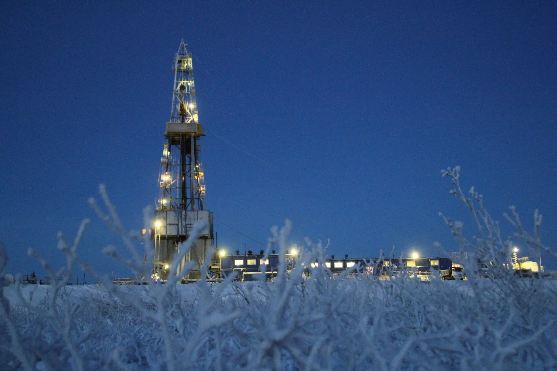
Gazprom Dobycha Noyabrsk has carried out large-scale seismic surveys at the Annensky subsoil site in Russia’s Kamchatka Territory, using advanced three-dimensional (3D) seismic surveying methods. The technology makes it possible to create a digital model of underground structures and identify oil and gas reserves with minimal environmental impact, the company’s press service told IT Russia.
A “Subsurface Map” That Shows Everything
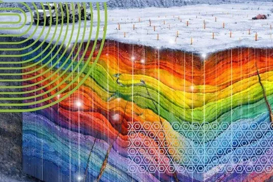
Modern oil and gas exploration is no longer possible without 3D seismic surveying. The method enables the creation of a detailed “subsurface map” showing rock layers, faults, and potential hydrocarbon-bearing zones. Unlike outdated two-dimensional (2D) seismic surveys, it provides a continuous picture across the entire licensed area, significantly improving the accuracy of geological forecasts.
The key advantage of 3D seismic surveying is that it not only identifies promising zones but also maps their shape and internal structure in detail. Geologists can see exactly where productive reservoirs are located and whether faults could compromise their integrity. As a result, the risk of drilling non-productive wells is reduced to a minimum, allowing specialists to plan field development more efficiently.
How does 3D seismic surveying work? A grid of survey lines is designed in advance, along which sensitive sensors are installed at 50-meter intervals to capture even the slightest ground vibrations. During the work at the Annensky site, several tens of thousands of such sensors were deployed, ensuring high data density. Each section of the subsurface was scanned multiple times from different directions.
An Indispensable Tool
Once fieldwork is completed, the data-processing stage begins. Raw signals are cleaned, filtered to remove noise, and corrected for terrain irregularities and the properties of near-surface layers. Software systems then integrate the data, allowing specialists to build geological models that are subsequently analyzed by interpretation geologists.
Another key feature of the method is the detailed analysis of productive horizons. Geologists can assess in advance how a reservoir is likely to behave during development — which zones will deliver the highest oil or gas flow and where potential issues may arise. This significantly reduces the cost of bringing a field into production.
3D seismic surveying has become an indispensable tool for refining the structure of productive reservoirs. It lowers drilling risks and makes field development more efficient.
Previously, we reported that Russian oil refineries are actively adopting advanced technologies for deeper processing of raw materials, with every drop of oil traveling a long path from the wellhead to a vehicle’s fuel tank.