Yandex Maps Learns to Build Routes Through Parks and Busy Streets
Yandex Maps has updated its pedestrian navigation system, allowing users to choose from multiple route options based on their preferences and current conditions.
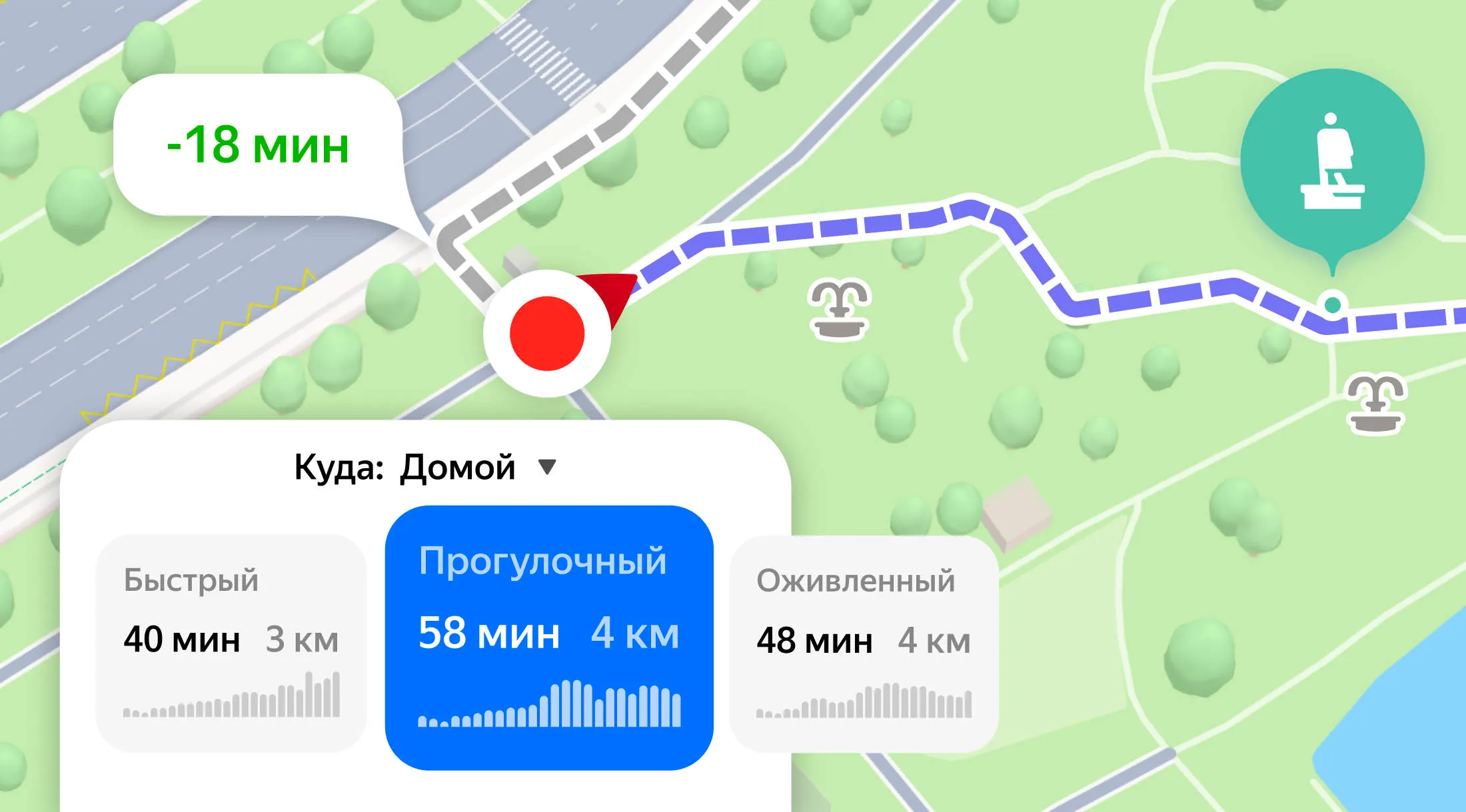
Previously, the application offered only the fastest route. Now, artificial intelligence analyzes the urban environment—including parks, elevation changes, street types, and building density—and generates several labeled route options.
The “Scenic” route guides users through parks and waterfronts, the “Busy Streets” option follows well-trafficked roads while avoiding courtyards and isolated areas, and the “Easier” route bypasses steep climbs. For people traveling with strollers or luggage, the service also offers “With Ramps,” “Fewer Stairs,” and “No Stairs” options. The updated navigation system is available to users across Russia.